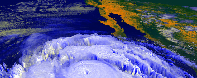
 A rendering of Hurricane Linda, which was briefly forecast to move toward Southern California in 1997. Image courtesy NASA.
Californians have mastered disaster. They see earthquakes, wildfires, landslides and massive traffic jams on the Santa Monica Freeway as the price of living life mostly in the sunshine – and besides, at least hurricanes never happen there.
Except once in a very rare while, when they do.
Only one tropical system made landfall in the Golden State in the 20th century. It was a tropical storm that passed over Catalina Island and hit the mainland at Long Beach in Los Angeles County in 1939. Some years back, researchers who were looking into that storm stumbled across old newspaper accounts showing that a full-fledged hurricane made a very close approach to San Diego in 1858. It traveled northward and dissipated just offshore. But the storm made it far enough north to drench Los Angeles in an unseasonably early downpour. Southern California ordinarily has nearly rainless summers before winter storms blow in off the Pacific Ocean.
There was an 81-year gap between these two systems, the only ones known to have made a direct approach to the Southern California coastline since statehood. You may have noticed that it is exactly 81 years since that 1939 tropical storm. You have almost certainly noticed that it is 2020, a year that seems bound and determined to do things that no self-respecting year would think of doing.
I am not trying to alarm anybody, and I am certainly not wishing a hurricane on Californians (or anyone else). Getting caught in a hurricane in California is a highly improbable event. It is particularly improbable this year, for reasons I will explain shortly. But that doesn’t make it impossible. You know, because it’s 2020.
Tropical cyclones are usually, although not always, born in the tropics. They develop from clusters of thunderstorms traveling through a moist atmospheric environment, over warm ocean waters and without too much crosswind, or wind shear, in the upper air that can tear them apart.
The magic number for a tropical cyclone – which includes, in decreasing order of strength, hurricanes (or typhoons in the western Pacific), tropical storms and tropical depressions – is 26. That’s 26 degrees Celsius, or 79 degrees Fahrenheit: the sea surface temperature above which cyclones can draw strength, and below which they tend to lose it. The warmer the water, the more fuel for the storm to put to work if the other conditions are right.
During the Atlantic hurricane season from June through November, conditions are generally favorable for these storms to develop almost anywhere between Africa and Central America, and northward to the Gulf of Mexico and the Southeast Atlantic coastline, where the warm Gulf Stream current provides extra fuel. Even outside hurricane season, waters in some of that territory remain warm enough that tropical cyclones are known to occur in every month of the year.
In the tropical waters of the far eastern north Pacific, off Central America and southern Mexico, conditions are often even more favorable. Hurricane season in that area officially begins on May 15, rather than June 1 as in the Atlantic, although both seasons end on Nov. 30. But to the north of those warm tropical waters, the California Current carries chilly water past the entire U.S. West Coast and dumps it west of Mexico’s Baja California peninsula.
Most eastern Pacific cyclones die when they move northwestward over that cold water. A few each year take a more northerly route and strike the southern coast of Mexico or the lower Baja peninsula with hurricane force. The occasional traveler takes a southerly route to the west, emerging in the central Pacific where somewhat more congenial waters allow a northward turn toward Hawaii. Rarely, one tries to sneak up the Sea of Cortez. That’s the body of water we Americans conceitedly call the Gulf of California, although it lies entirely within Mexico.
More or less every summer, moisture from the remnants of these storms will be drawn northward into our southwestern deserts. There, it triggers the intense thunderstorms that are a hallmark of the region’s monsoon season. Yes, America has monsoons, every year, although you might not know it if you don’t live in that part of the country. Once in a while, conditions draw some of that moisture as far west as the southern California coastline and mountains, which feeds the rare summer rains in the area.
But that cold California Current has been called hurricane repellant. Almost no storms survive intact after traversing that hostile territory. Most of the time, the atmosphere’s currents don’t point them that way in the first place.
If everything lines up just right, though, the improbable can happen. “Just right” would mean a powerful cyclone emerging over the tropics, and traveling quickly and directly enough across the colder water to retain its tropical nature as it crosses the border. It helps if the cold water is not as cold as usual, so the best years for this to occur are when there is a strong El Nino event.
In our lifetimes, the monster El Nino of 1997-98 probably created the best opportunity for this to happen. I remember paying particularly close attention to Pacific hurricanes in that autumn of 1997, since I had clients living along the coastline at the time as the nearby ocean waters warmed dramatically.
That summer, Tropical Storm Ignacio took a run at the state. It lost its tropical nature off northern Baja. But the associated moisture created anomalous summer rain all the way north past San Francisco (which ended up with its wettest August on record) to the Pacific Northwest.
This is not an El Nino year. In fact, last week the Climate Prediction Center of the National Weather Service predicted a 60% chance that the inverse La Nina conditions will develop by this autumn, with a greater-than-even chance it will continue through the winter. This means average to colder-than-average water conditions are likely in the tropical Eastern Pacific.
So, as I said, a tropical cyclone hitting Southern California remains an extremely unlikely event, this year or any year. But it isn’t impossible. After all, if California is on an 81-year schedule, then the timing is right. And it’s 2020.


Posted by Larry M. Elkin, CPA, CFP®
A rendering of Hurricane Linda, which was briefly forecast to move toward Southern California in 1997. Image courtesy NASA.
Californians have mastered disaster. They see earthquakes, wildfires, landslides and massive traffic jams on the Santa Monica Freeway as the price of living life mostly in the sunshine – and besides, at least hurricanes never happen there.
Except once in a very rare while, when they do.
Only one tropical system made landfall in the Golden State in the 20th century. It was a tropical storm that passed over Catalina Island and hit the mainland at Long Beach in Los Angeles County in 1939. Some years back, researchers who were looking into that storm stumbled across old newspaper accounts showing that a full-fledged hurricane made a very close approach to San Diego in 1858. It traveled northward and dissipated just offshore. But the storm made it far enough north to drench Los Angeles in an unseasonably early downpour. Southern California ordinarily has nearly rainless summers before winter storms blow in off the Pacific Ocean.
There was an 81-year gap between these two systems, the only ones known to have made a direct approach to the Southern California coastline since statehood. You may have noticed that it is exactly 81 years since that 1939 tropical storm. You have almost certainly noticed that it is 2020, a year that seems bound and determined to do things that no self-respecting year would think of doing.
I am not trying to alarm anybody, and I am certainly not wishing a hurricane on Californians (or anyone else). Getting caught in a hurricane in California is a highly improbable event. It is particularly improbable this year, for reasons I will explain shortly. But that doesn’t make it impossible. You know, because it’s 2020.
Tropical cyclones are usually, although not always, born in the tropics. They develop from clusters of thunderstorms traveling through a moist atmospheric environment, over warm ocean waters and without too much crosswind, or wind shear, in the upper air that can tear them apart.
The magic number for a tropical cyclone – which includes, in decreasing order of strength, hurricanes (or typhoons in the western Pacific), tropical storms and tropical depressions – is 26. That’s 26 degrees Celsius, or 79 degrees Fahrenheit: the sea surface temperature above which cyclones can draw strength, and below which they tend to lose it. The warmer the water, the more fuel for the storm to put to work if the other conditions are right.
During the Atlantic hurricane season from June through November, conditions are generally favorable for these storms to develop almost anywhere between Africa and Central America, and northward to the Gulf of Mexico and the Southeast Atlantic coastline, where the warm Gulf Stream current provides extra fuel. Even outside hurricane season, waters in some of that territory remain warm enough that tropical cyclones are known to occur in every month of the year.
In the tropical waters of the far eastern north Pacific, off Central America and southern Mexico, conditions are often even more favorable. Hurricane season in that area officially begins on May 15, rather than June 1 as in the Atlantic, although both seasons end on Nov. 30. But to the north of those warm tropical waters, the California Current carries chilly water past the entire U.S. West Coast and dumps it west of Mexico’s Baja California peninsula.
Most eastern Pacific cyclones die when they move northwestward over that cold water. A few each year take a more northerly route and strike the southern coast of Mexico or the lower Baja peninsula with hurricane force. The occasional traveler takes a southerly route to the west, emerging in the central Pacific where somewhat more congenial waters allow a northward turn toward Hawaii. Rarely, one tries to sneak up the Sea of Cortez. That’s the body of water we Americans conceitedly call the Gulf of California, although it lies entirely within Mexico.
More or less every summer, moisture from the remnants of these storms will be drawn northward into our southwestern deserts. There, it triggers the intense thunderstorms that are a hallmark of the region’s monsoon season. Yes, America has monsoons, every year, although you might not know it if you don’t live in that part of the country. Once in a while, conditions draw some of that moisture as far west as the southern California coastline and mountains, which feeds the rare summer rains in the area.
But that cold California Current has been called hurricane repellant. Almost no storms survive intact after traversing that hostile territory. Most of the time, the atmosphere’s currents don’t point them that way in the first place.
If everything lines up just right, though, the improbable can happen. “Just right” would mean a powerful cyclone emerging over the tropics, and traveling quickly and directly enough across the colder water to retain its tropical nature as it crosses the border. It helps if the cold water is not as cold as usual, so the best years for this to occur are when there is a strong El Nino event.
In our lifetimes, the monster El Nino of 1997-98 probably created the best opportunity for this to happen. I remember paying particularly close attention to Pacific hurricanes in that autumn of 1997, since I had clients living along the coastline at the time as the nearby ocean waters warmed dramatically.
That summer, Tropical Storm Ignacio took a run at the state. It lost its tropical nature off northern Baja. But the associated moisture created anomalous summer rain all the way north past San Francisco (which ended up with its wettest August on record) to the Pacific Northwest.
This is not an El Nino year. In fact, last week the Climate Prediction Center of the National Weather Service predicted a 60% chance that the inverse La Nina conditions will develop by this autumn, with a greater-than-even chance it will continue through the winter. This means average to colder-than-average water conditions are likely in the tropical Eastern Pacific.
So, as I said, a tropical cyclone hitting Southern California remains an extremely unlikely event, this year or any year. But it isn’t impossible. After all, if California is on an 81-year schedule, then the timing is right. And it’s 2020.
Related posts:
No related posts.